Never Lose Track of Your Land Again.
Document, Pin & Preserve Your Property
Lander lets you record the exact GPS location of your land so you — and your family — will always know where it is, even decades from now.
Available on:


Lander lets you record the exact GPS location of your land so you — and your family — will always know where it is, even decades from now.
Available on:


Land is one of the most valuable assets a person can own, yet so many landowners lose track of their property over time. Whether it's been 5 years or 25 years since you bought that plot, Lander ensures you always have a precise digital record — GPS coordinates, photos, documents, and a full history — right in your pocket.


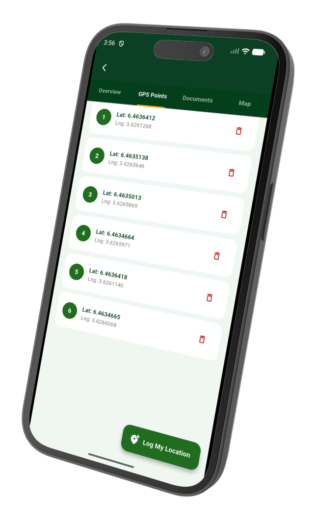
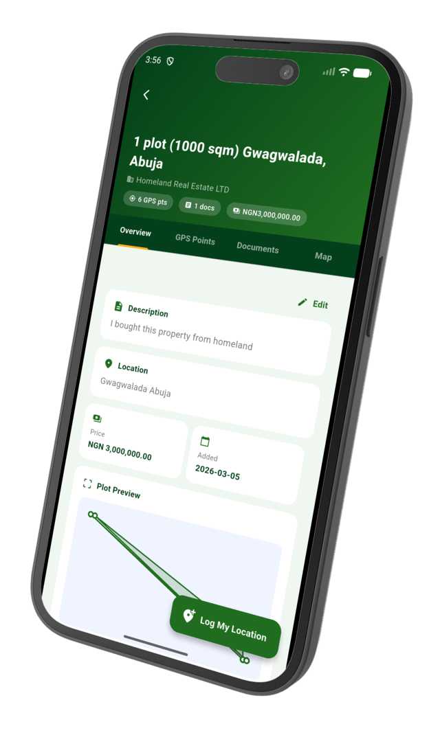
Drop a precise GPS pin on your land so you can always navigate back to it, no matter how much time passes.

Safely store your survey plans, deeds, receipts, and title documents in one secure digital vault.

Attach multiple photos of your property at different times to build a visual history of your land.

Share your property records with trusted family members so everyone knows where the land is.


Across generations, families lose their land simply because no one recorded where it was. Lander gives you a permanent, geo-tagged digital record of every plot you own — accessible anytime, anywhere. Stop relying on memory or faded receipts. Start documenting today.
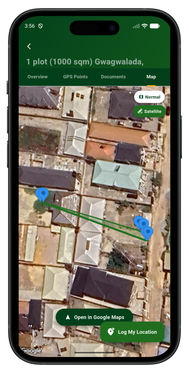
With Lander, you don't just save an address — you save the exact GPS coordinates of your land. Find your way back to your property years later with a single tap, using the interactive map view built right into the app.
Whether your land is in a developed estate or a remote rural area, our geo-pinning technology works everywhere on the globe — even offline once cached.


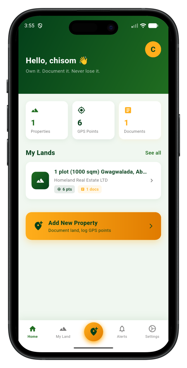
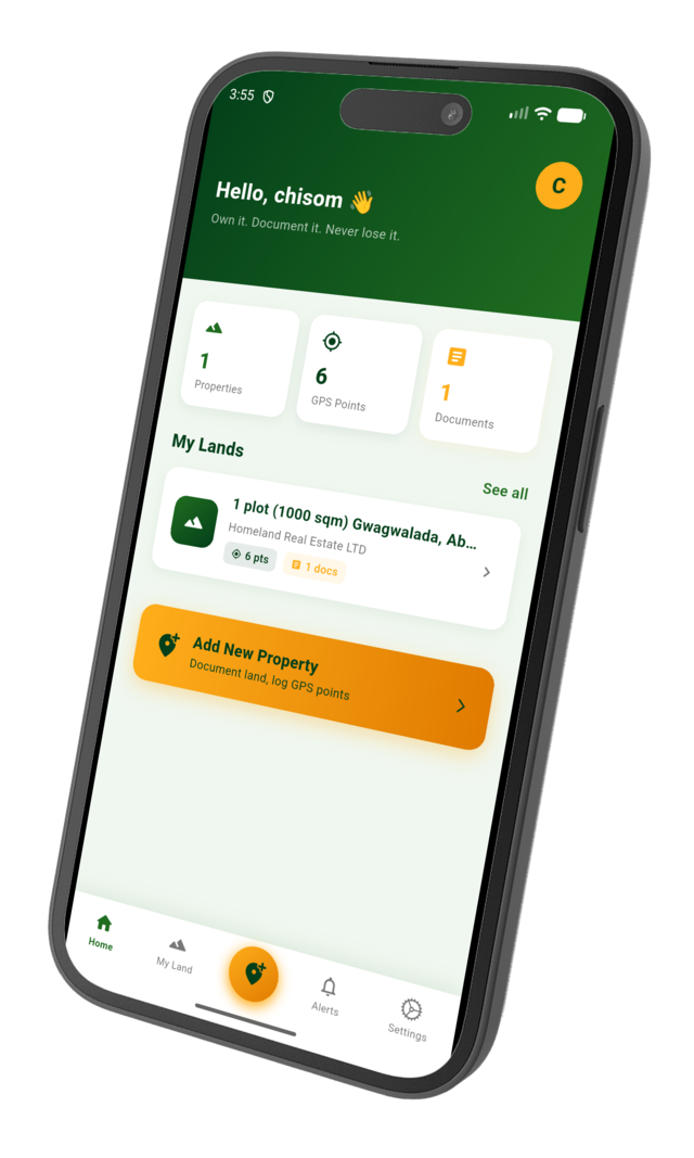
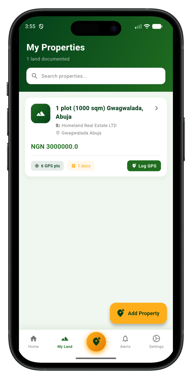
Own multiple plots? No problem. Lander lets you create a separate profile for each piece of land — with its own location, photos, documents, and notes — all neatly organized in one dashboard.
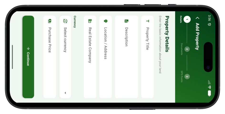
Add land type, purchase date, title information, and the name of the real estate company or surveyor involved — every important detail in one place.

From first-time buyers to multi-plot investors, Lander is the trusted platform for documenting and preserving land ownership records across the country.
Lander allows you to drop a GPS pin precisely on your land's location and save it to your account. You can add photos, upload documents like survey plans and receipts, and write detailed notes — creating a permanent digital record of exactly where your property is.
You can upload any document related to your land — survey plans, deed of assignment, receipts, government allocation letters, certificates of occupancy (C-of-O), and more. Supported formats include PDF, JPG, and PNG.
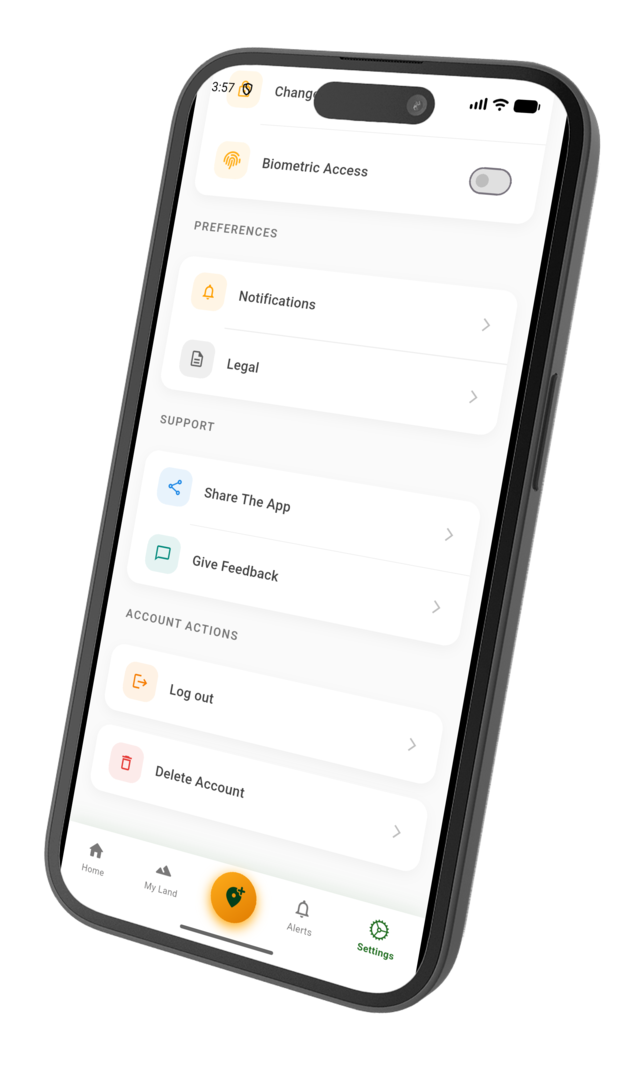
Absolutely. All your data is encrypted and stored securely on our servers. We use industry-standard security protocols to protect your personal information and property records. You can also download backups of all your data at any time.
Yes! With the Standard and Pro plans, you can share specific property records with family members or trusted individuals. Shared members can view the location, photos, and documents without being able to edit or delete anything.
Download the Lander app on your Android or iOS device and start documenting your land properties today. Available for free on the App Store and Google Play.