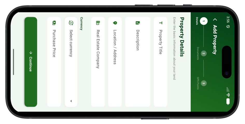


Lander lets you drop a precise GPS pin on the exact location of your land and save it to your account. You can attach photos, upload documents like survey plans and receipts, and write detailed notes — creating a permanent, accessible record of your property no matter how much time passes.
You can upload any land-related document — survey plans, deed of assignment, purchase receipts, allocation letters, certificate of occupancy (C-of-O), and more. Supported formats include PDF, JPG, and PNG. All documents are securely stored and accessible anytime from your account.
Yes. All your data is encrypted and stored on secure servers. We use industry-standard security protocols to protect your personal information, property location data, and uploaded documents. You can also export and download backups of all your records at any time from the Pro plan.
Yes! With the Standard and Pro plans, you can share specific property records with family members or trusted individuals. Shared members can view the location, photos, and documents without having the ability to edit or delete your records. This is perfect for families with jointly owned land.
Your data is always stored in the cloud, not just on your device. If you lose your phone, simply log in to your Lander account from any other device and all your property records, GPS pins, photos, and documents will be right there waiting for you.
Once your property data and map tile is cached, you can view your previously saved properties and GPS locations offline. However, adding new properties, uploading documents, or syncing changes requires an active internet connection. We recommend caching your field locations before visiting remote areas without signal.
Download the Lander app on your Android or iOS device and start documenting your land properties today. Available for free on the App Store and Google Play.